NOAA APT Reception Archive 2022–2024
Between 2022 and 2024, the OE6VAG receiving station regularly received analogue weather images from the NOAA Polar Operational Environmental Satellites NOAA-15, NOAA-18 and NOAA-19.
The satellites transmitted their images using APT – Automatic Picture Transmission in the 137 MHz weather-satellite band.
APT was one of the most accessible forms of direct weather-satellite reception: a relatively simple VHF antenna, an SDR receiver and suitable decoding software were sufficient to receive weather imagery directly from a satellite passing overhead.
This page preserves a representative selection from the local OE6VAG NOAA APT image archive.
The original archive contains hundreds of processed image files. This number is larger than the actual number of satellite passes because the processing software generated several different image products from many individual receptions.
The images shown here are therefore a curated selection rather than a complete archive.
👉 Back to VHF and UHF Radio Monitoring & Signal Decoding
Receiving NOAA APT
The receiving process was based on the characteristic analogue APT downlink transmitted by the NOAA weather satellites.
A typical reception chain was:
NOAA satellite
      ↓
137 MHz APT transmission
      ↓
VHF satellite antenna
      ↓
SDR receiver
      ↓
WXtoImg
      ↓
APT image processing
      ↓
weather image
Because the satellites were in low Earth orbit, reception was only possible during a pass over the receiving location.
The resulting image quality depended strongly on:
- maximum pass elevation
- antenna radiation pattern
- local horizon
- interference
- receiver gain
- Doppler shift
- signal fading during the pass
A high-elevation pass could produce a long, clean image covering a large geographic area, while a low pass might contain only a narrow usable section.
Typical Audio of NOAA satellite
Image Processing
The received APT signal contained two analogue image channels transmitted side by side.
WXtoImg was used to reconstruct and process the received satellite imagery.
For many passes, several different processed versions were generated automatically.
The local archive therefore contains enhancement types such as:
- MCIR
- HVCT
- MSA
- Contrast enhancements
- Normal / unenhanced images
For this historical gallery, visually useful colour-enhanced images were preferred over the basic monochrome products.
The objective is not to preserve every automatically generated processing variant on the website, but to show representative examples of what could actually be received from each satellite.
NOAA-15
NOAA-15 was one of the three NOAA satellites received by the station during the archive period.
Like the other POES satellites, it transmitted analogue APT imagery in the 137 MHz satellite band.
The following images are selected examples from locally received NOAA-15 passes.
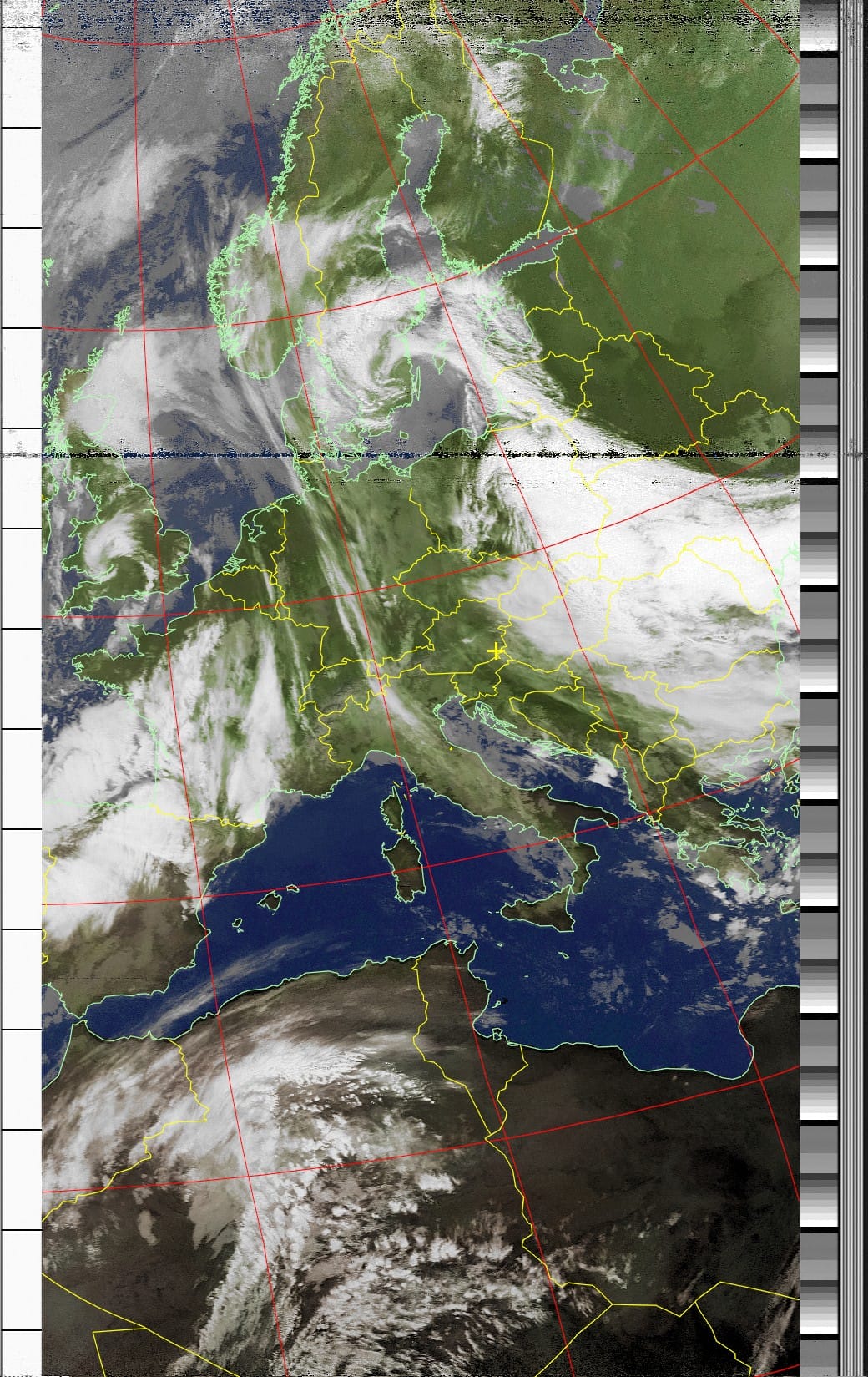
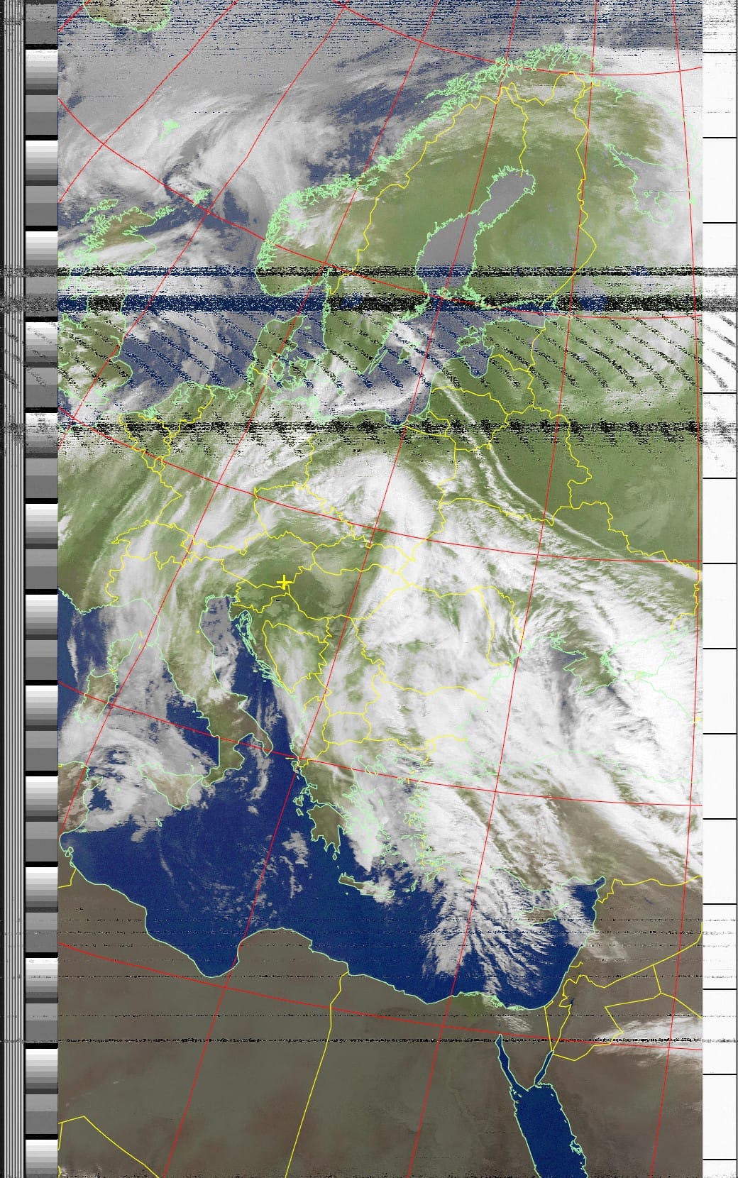
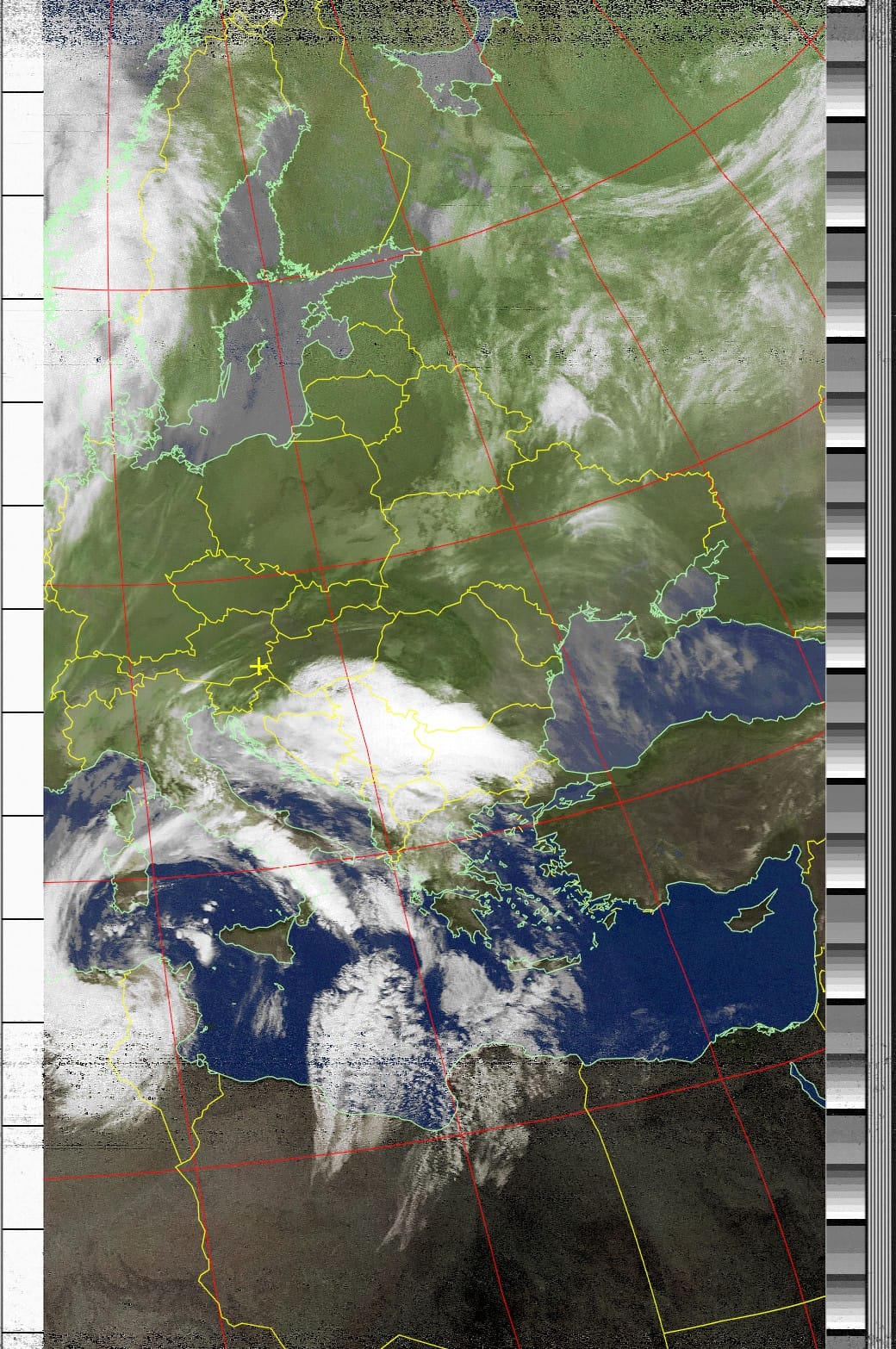
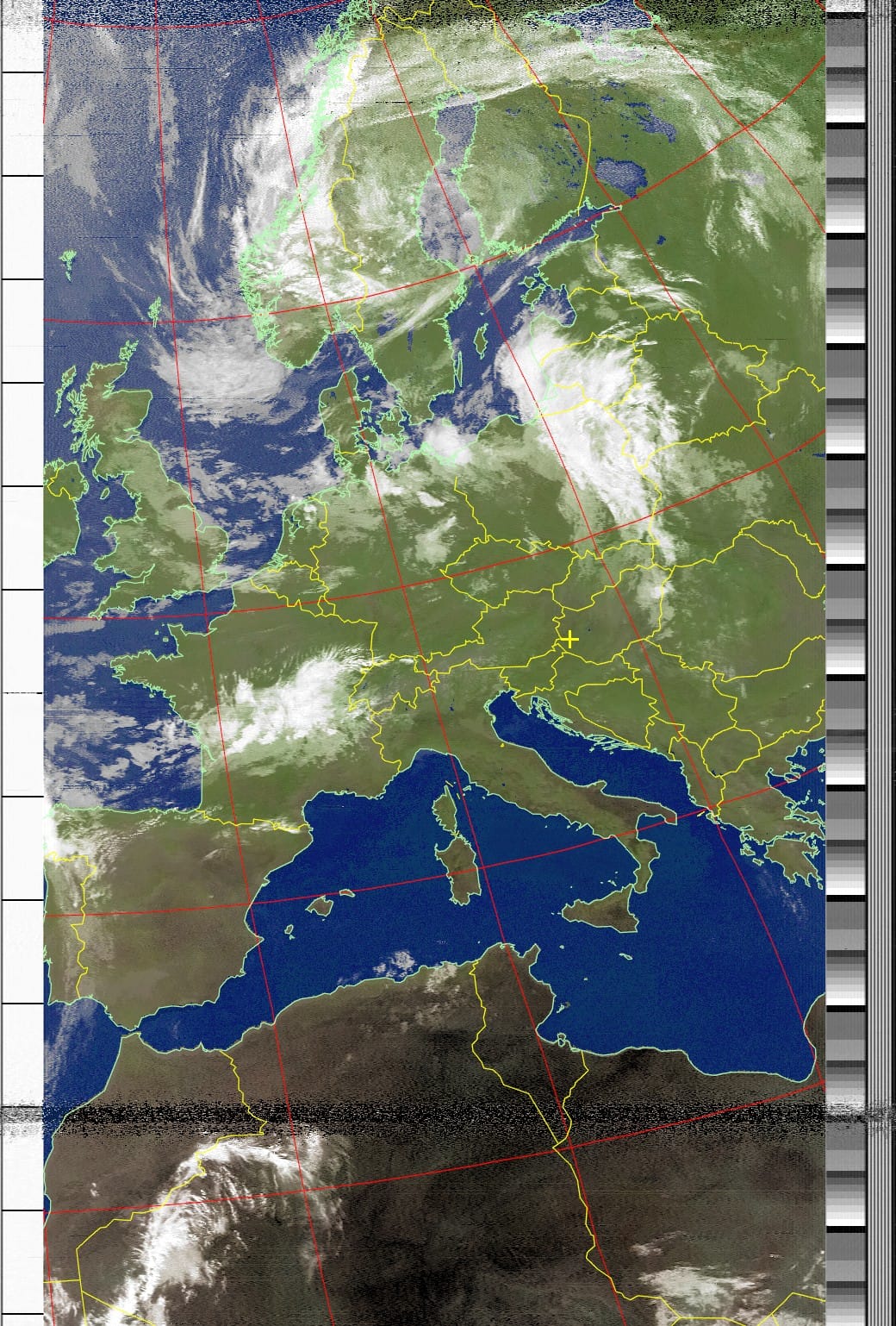
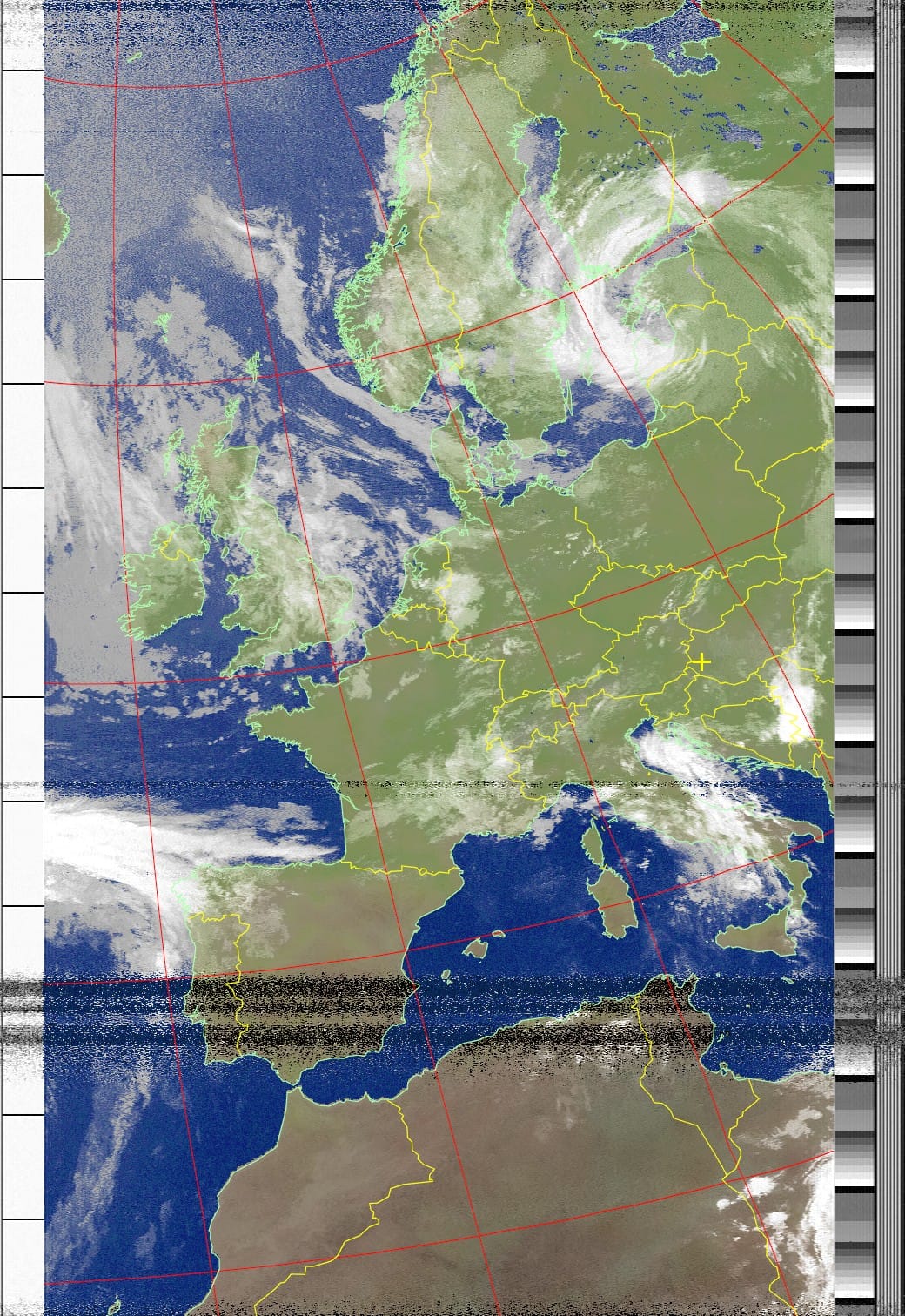
Selected NOAA-15 APT receptions from the OE6VAG archive.
NOAA-18
NOAA-18 provided another regular source of APT weather imagery.
Differences between individual receptions are caused not only by changing weather conditions but also by satellite geometry, pass direction, maximum elevation and RF reception conditions.
The examples below were received and decoded locally.
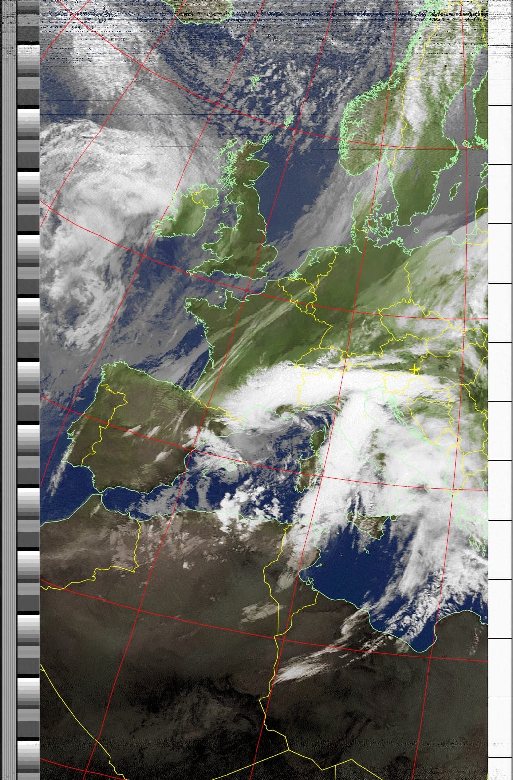
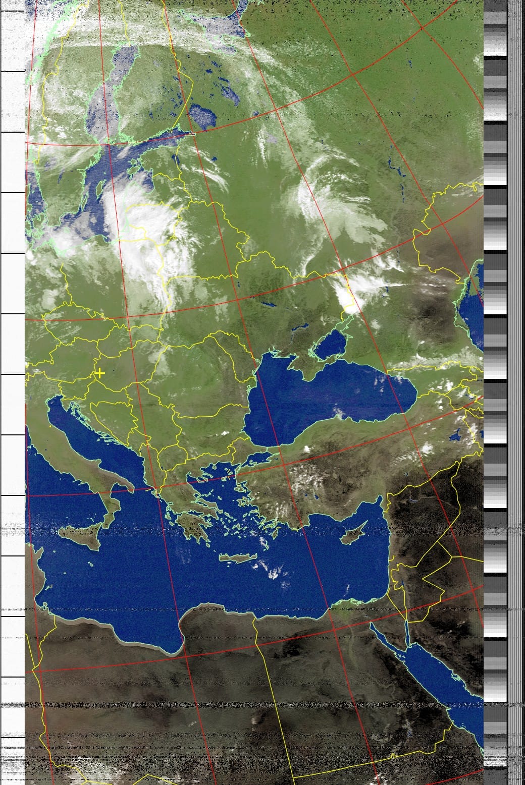
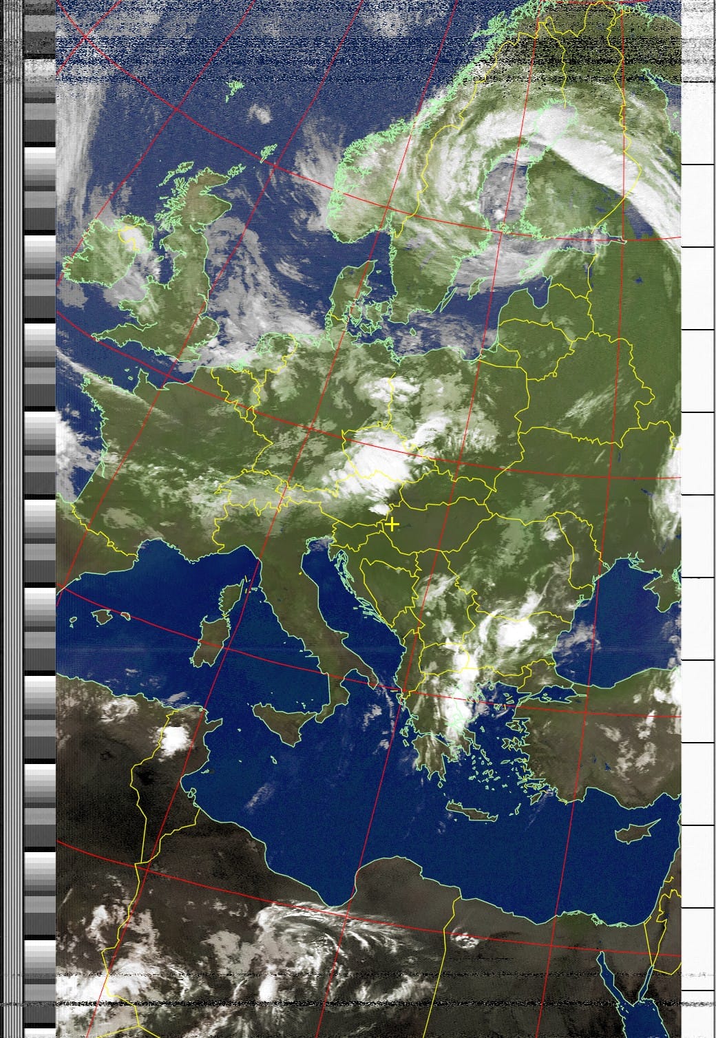
Selected NOAA-18 APT receptions from the OE6VAG archive.
NOAA-19
NOAA-19 accounts for a particularly large part of the preserved OE6VAG archive.
The satellite was received during several separate periods between 2022 and 2024, providing examples from different seasons and reception conditions.
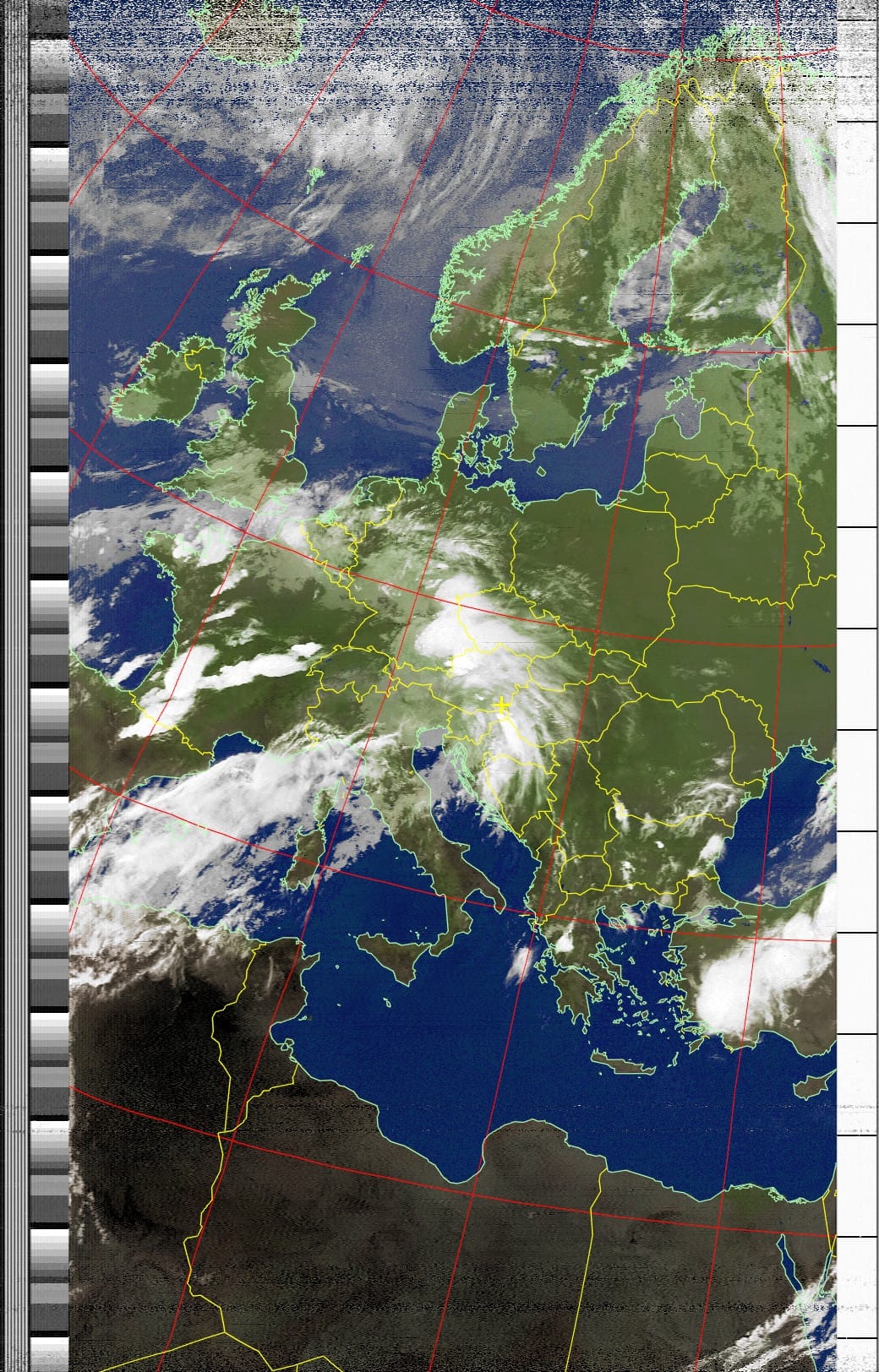
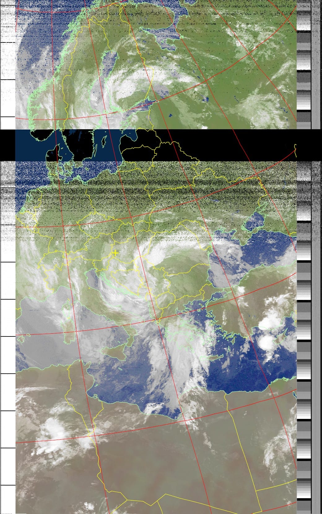
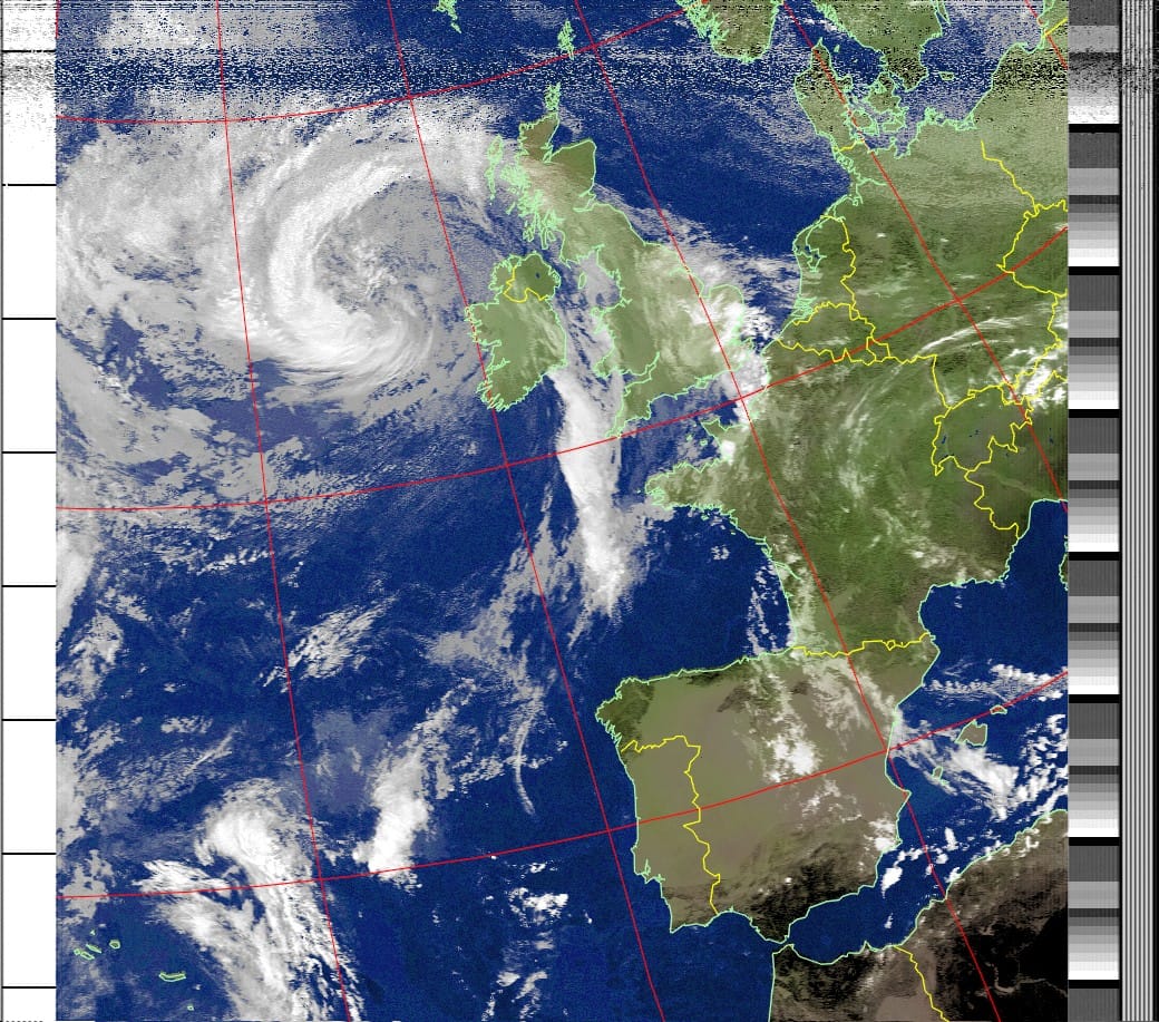
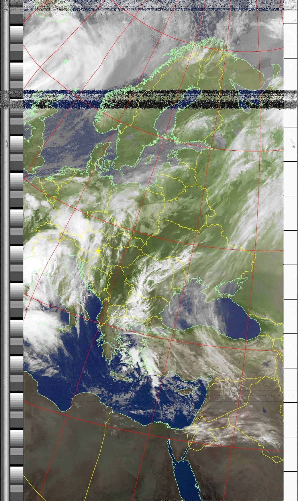
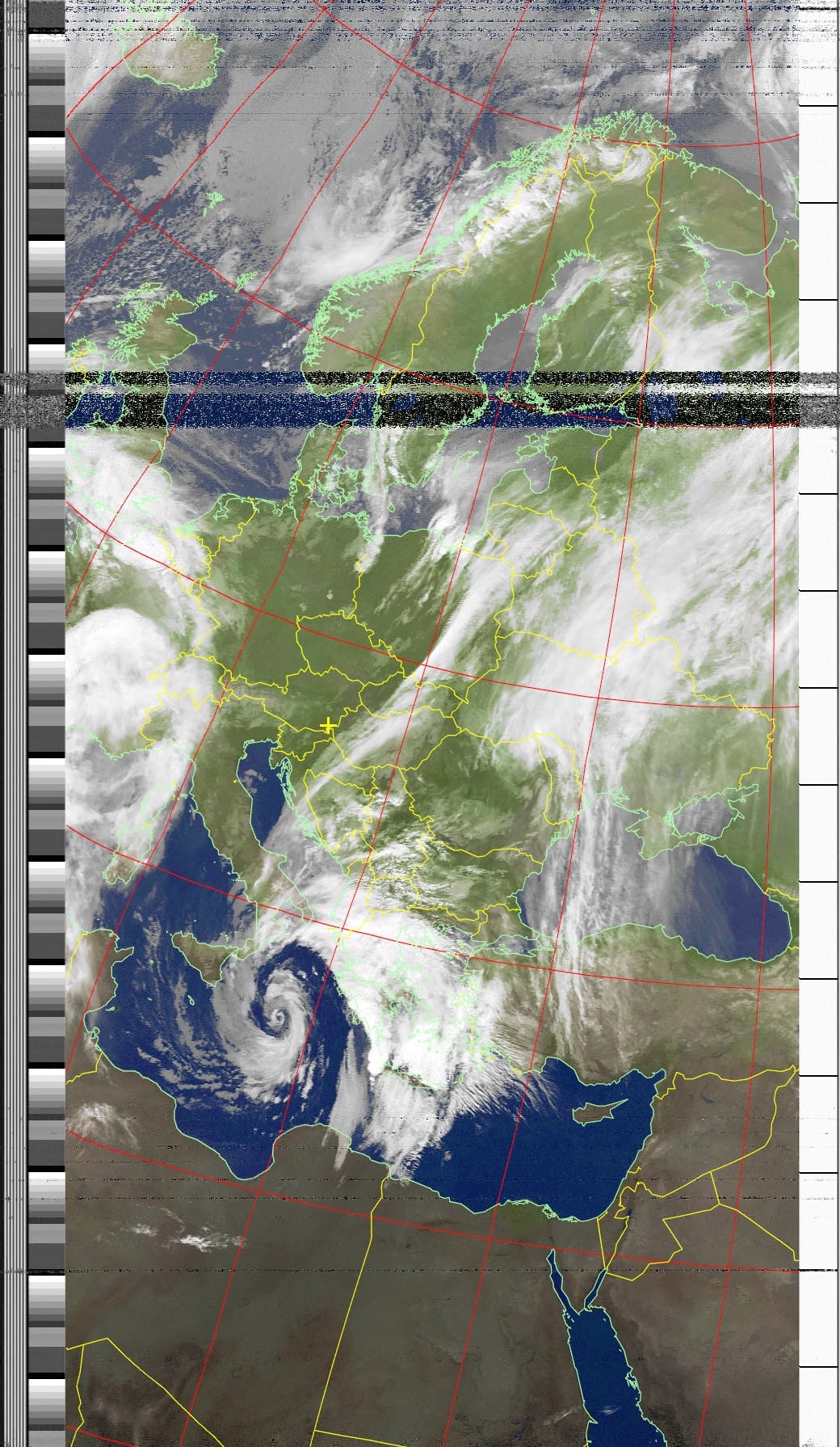
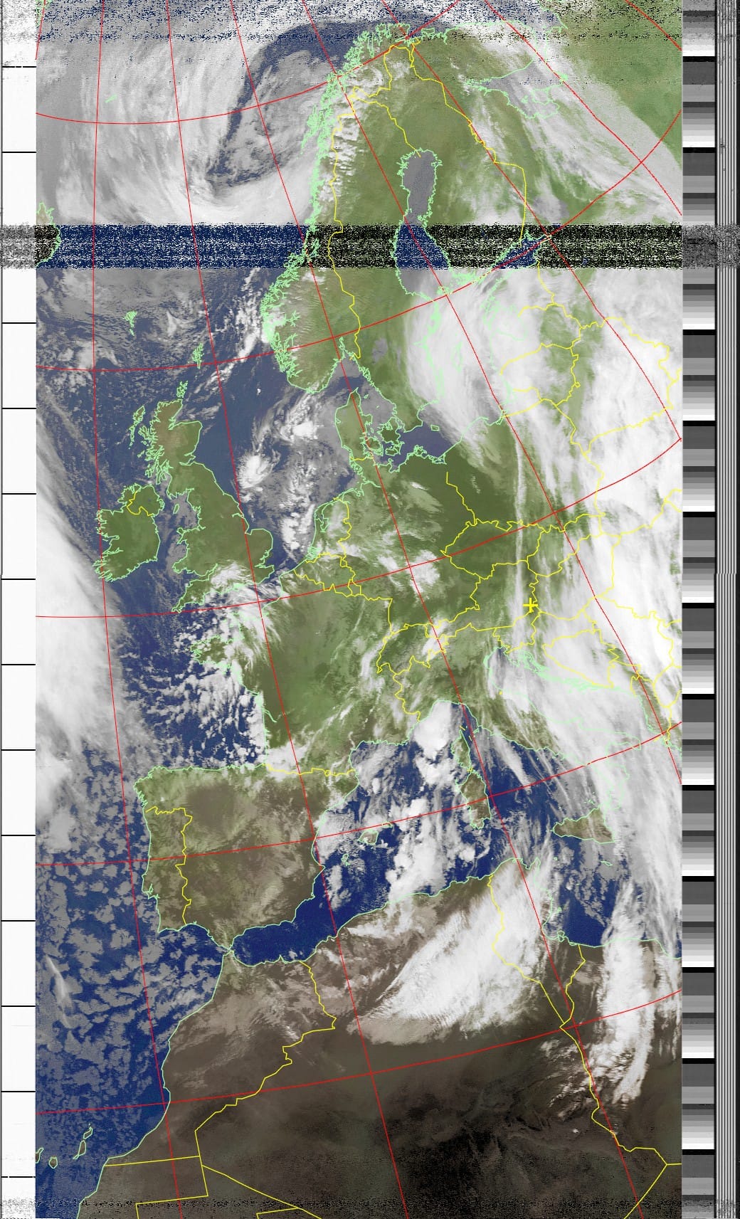
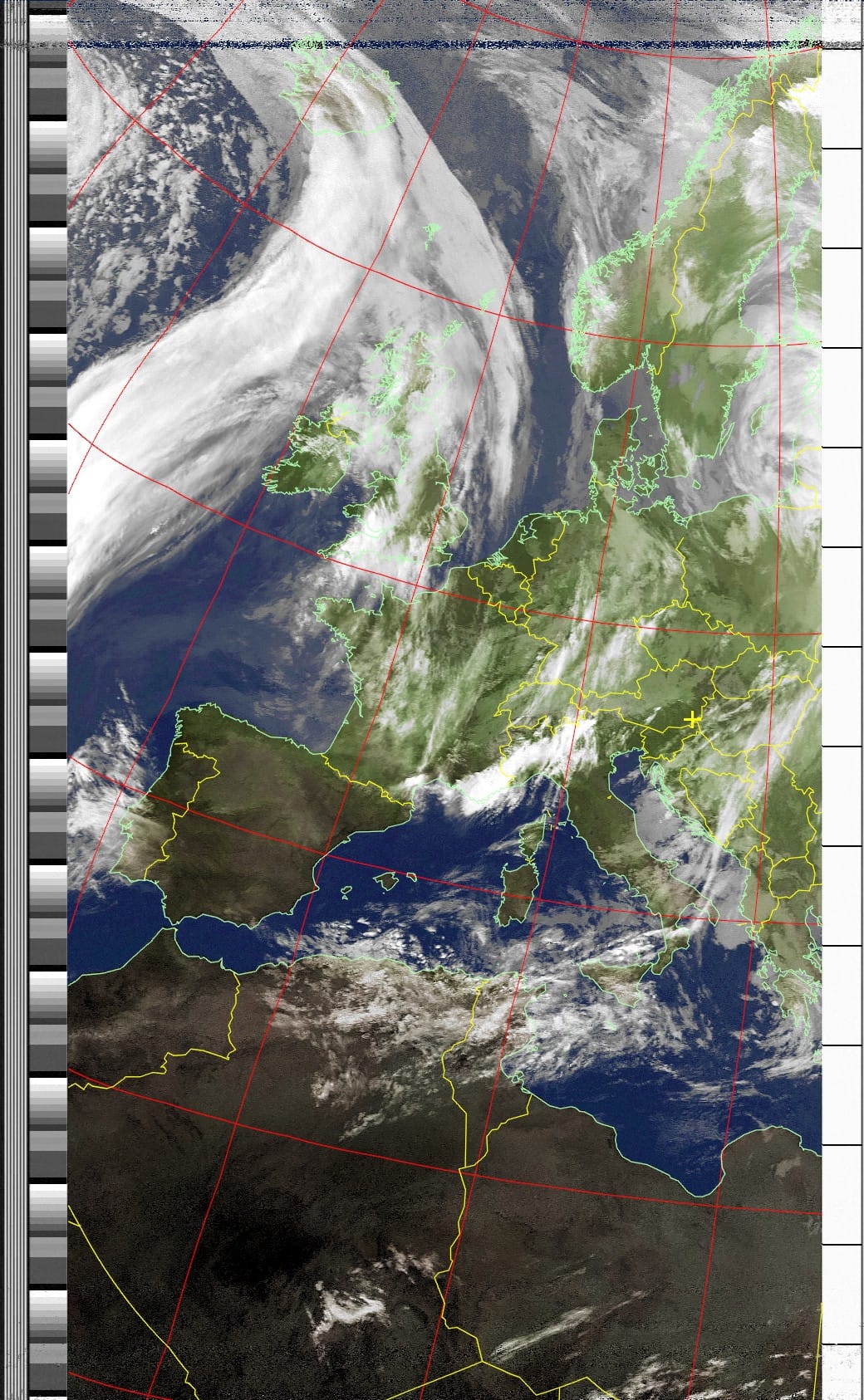
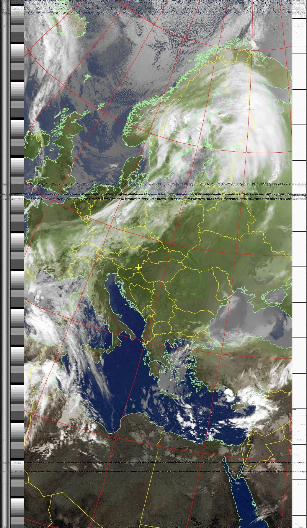
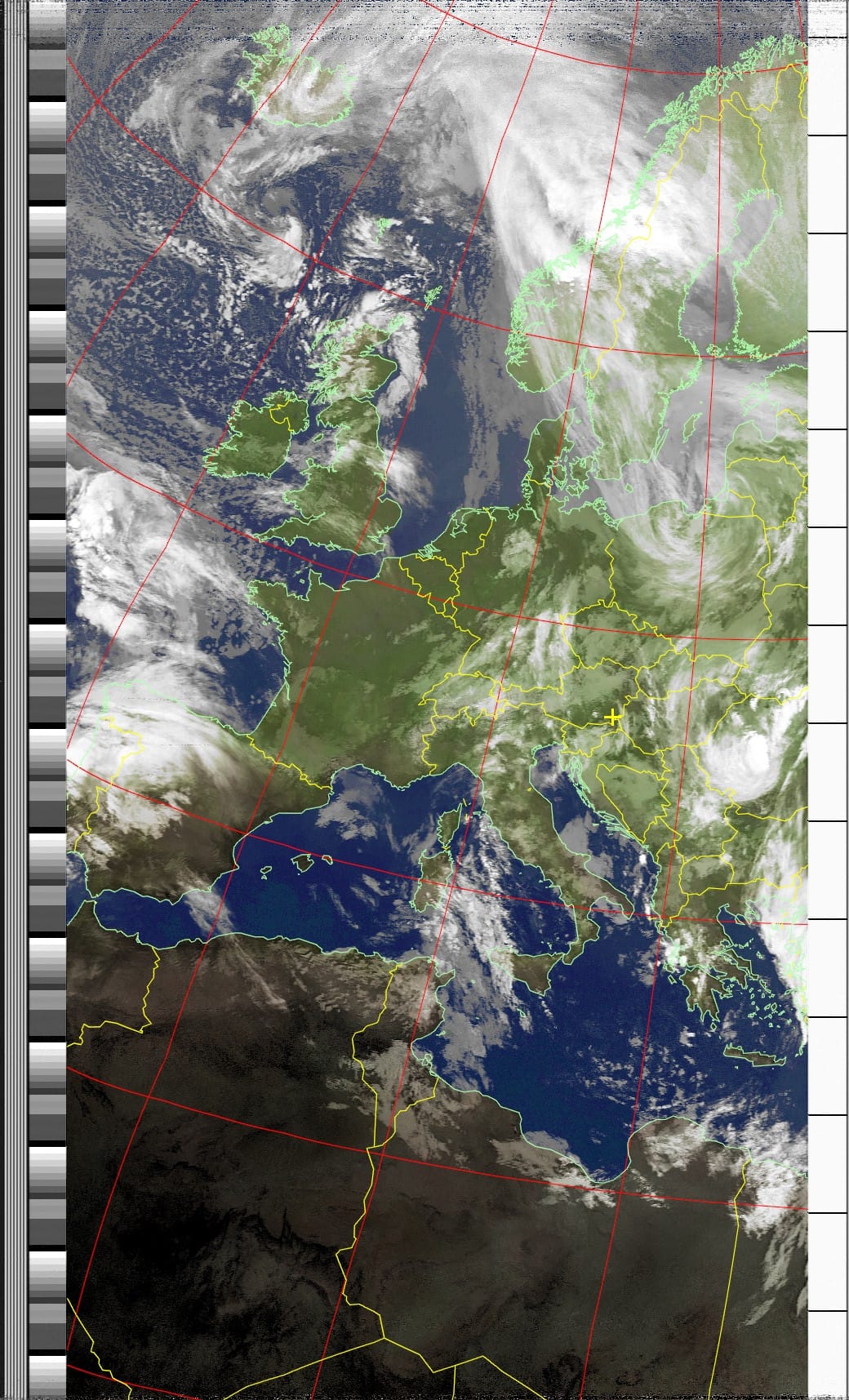
Selected NOAA-19 APT receptions from the OE6VAG archive.
Combined Northbound and Southbound Images
In addition to the individual satellite-pass products, the archive contains combined images generated from multiple receptions.
These files use names such as:
noaa-20240226-n-mcir.png
noaa-20240226-s-mcir.png
where:
- n represents a northbound group of passes
- s represents a southbound group of passes
- the final identifier represents the selected WXtoImg processing mode
These composites are particularly useful because they provide a broader view than an individual satellite pass.
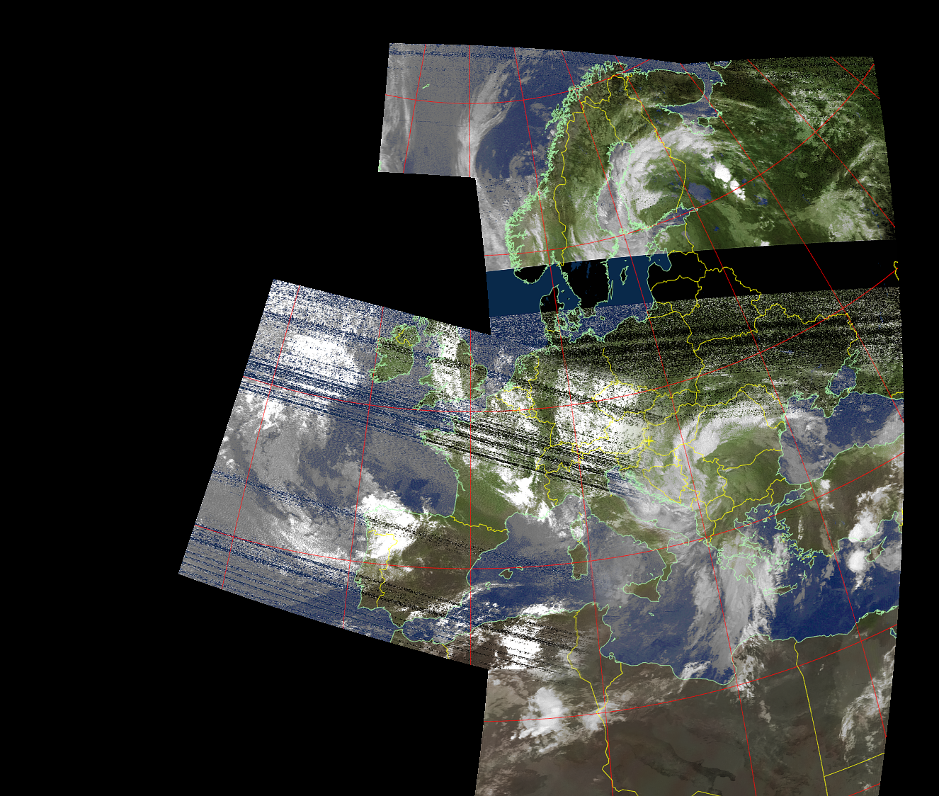
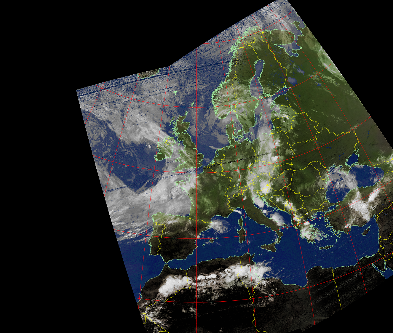
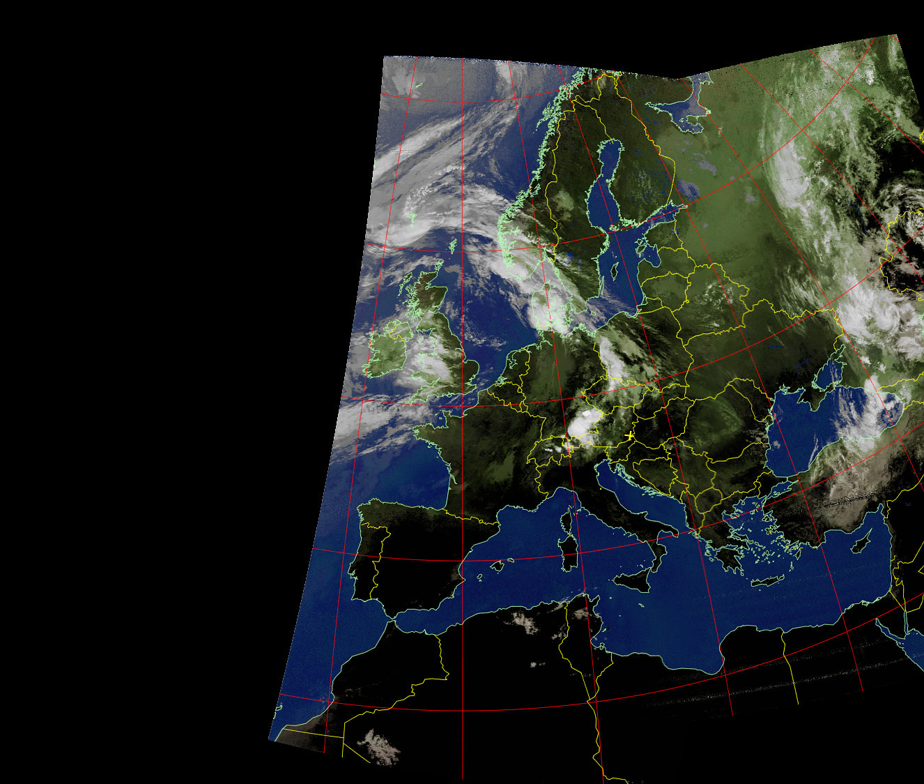
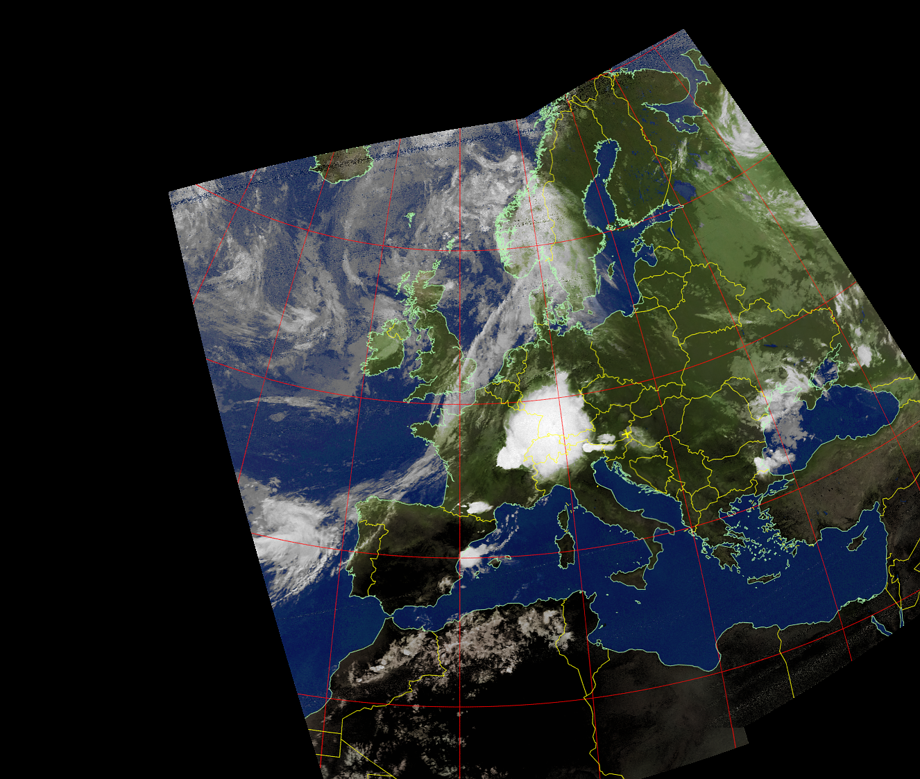
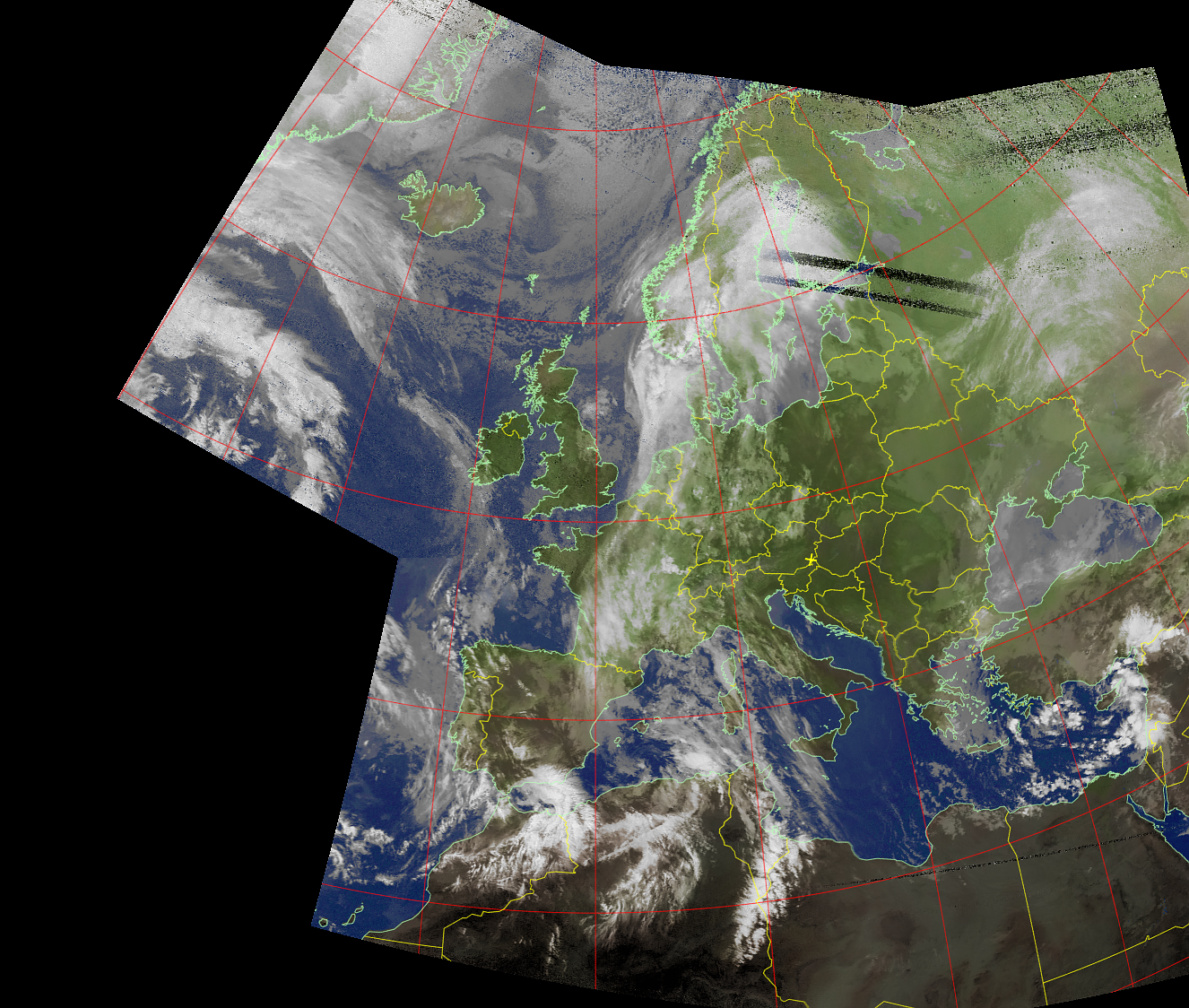
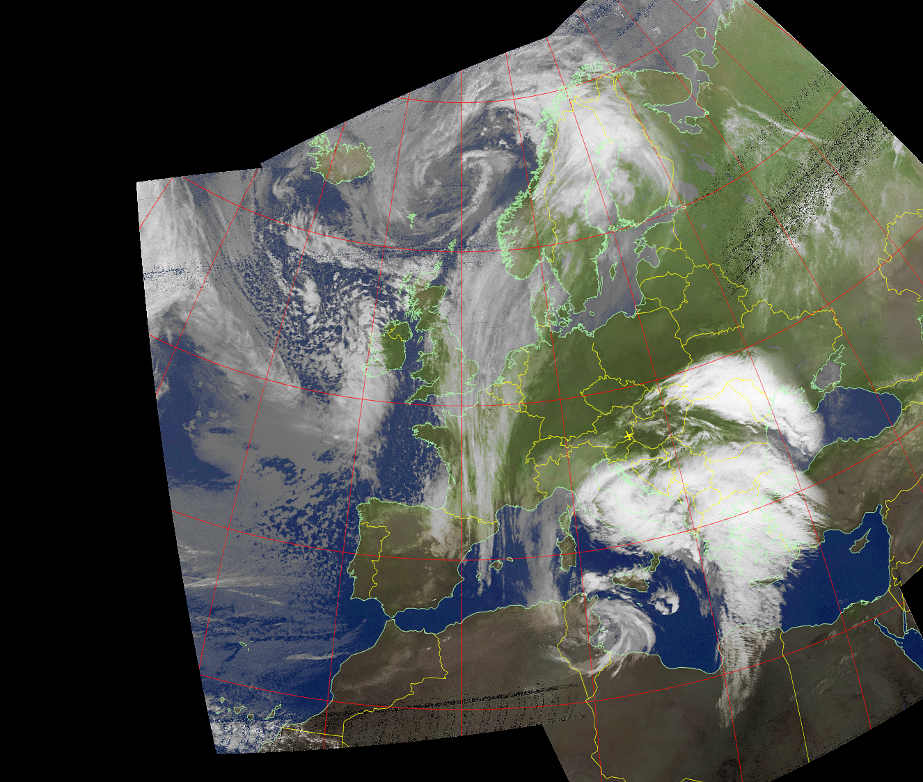
Selected northbound and southbound NOAA APT composite images.
What the Images Show
APT imagery is fundamentally different from modern Internet weather maps.
These images were created directly from an RF signal received from the satellite.
Reception imperfections therefore remain visible.
Typical effects include:
- noise toward the beginning or end of a pass
- horizontal interference lines
- brief signal dropouts
- image distortion caused by weak reception
- reduced coverage during low-elevation passes
- differences between daylight and nighttime imagery
These imperfections are part of the reception process and are intentionally preserved.
The images document what the local receiving station actually received rather than a downloaded satellite product.
From NOAA APT to METEOR LRPT
The NOAA APT archive represents an earlier generation of the OE6VAG weather-satellite project.
The current system uses METEOR-M2-4 and its digital LRPT – Low Rate Picture Transmission downlink.
The principle remains similar:
satellite
   ↓
local RF reception
   ↓
digital signal processing
   ↓
image reconstruction
   ↓
web publication
But the technology has changed considerably.
METEOR LRPT uses a digital modulation and provides image data that are processed with SatDump. The current receiving station also automates pass prediction, recording, decoding, image processing and publication.
This makes the NOAA APT archive an interesting comparison between two generations of direct weather-satellite reception.
👉 METEOR-M2-4 on the Live Data page
👉 Autonomous Radio Monitoring Stations
Historical Archive
The original NOAA files remain stored locally as a historical reception archive.
Only a small representative selection is published here.
The purpose of this page is not to provide a complete meteorological dataset, but to preserve examples of practical 137 MHz direct satellite reception carried out by the OE6VAG station between 2022 and 2024.
The original files have been retained without replacing them with downloaded or externally processed satellite images.
All gallery images on this page originate from local OE6VAG radio reception.
Related OE6VAG Pages
👉 VHF and UHF Radio Monitoring & Signal Decoding